Share this:
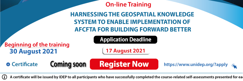
30 August, 2021 to 15 October, 2021
The United Nations 2030 Agenda for Sustainable Development; and the African Union Agenda 2063 emphasizes the need for global Geospatial Information for Sustainable Development (GI4SD) management.
In the current digitalisation era, geospatial technologies are revolutionizing the economy. From navigating public transport to tracking supply chains and planning efficient delivery routes, the digital services built on GPS and current mapping data have quietly become part of daily life and trade. With the increase of mobile technology and communications, handheld smartphones have democratized mapping, moving geospatial technology into the hands of every individual. Bottom-up, commercial, and consumer-driven information platforms and applications are innovative and have had big impacts on society.
Digital platforms, logistics technologies, and data-processing advances will continue to reduce cross-border transaction costs and enable all types of flows. GIS-based market analysis help in presenting the relationship between the components of the market; that is, the customers, suppliers, and competitors. Strategies such as target marketing, micro-marketing, and relationship marketing all require that firms capture and maintain detailed information about their customers. GIS is a powerful tool in market analyses because it also provides a way to bring together data from multiple sources and link them based on spatial attributes.
As countries focus on building forward better, after the pandemic, the digitalisation of the AfCFTA becomes a strategic recovery plan.
It is in this context that IDEP and the African Statistics Center of the ECA are organizing an online training on "Harnessing the geospatial knowledge system to enable the implementation of the AfCFTA for building forward better".
The objectives of the course are to increase and improve awareness, knowledge and understanding of the IGIF and its role in the establishment of NSDI and Geospatial Information Strategies for the establishment of the AfCFTA.
It will deal with the availability and accessibility of geospatial information and its integration with statistics and other data in support of national development actions, and the implementation of the sustainable development agenda 2030 and agenda 2063 in response to the COVID-19 pandemic.